Visium
Human lung
GSM8187469
silver Interactive viewer H&E small cell lung carcinoma No linked publication
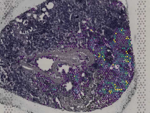
print(sdata)
SpatialData object
├── Images
│     └── 'GSM8187469_SCLC3_lowres_image': DataArray[cyx] (3, 600, 586)
├── Shapes
│     └── 'GSM8187469_SCLC3': GeoDataFrame shape: (3860, 2) (2D shapes)
└── Tables
      └── 'table': AnnData (3860, 33542)
with coordinate systems:
    ▸ 'GSM8187469_SCLC3', with elements:
        GSM8187469_SCLC3_lowres_image (Images), GSM8187469_SCLC3 (Shapes)
    ▸ 'GSM8187469_SCLC3_downscaled_hires', with elements:
        GSM8187469_SCLC3 (Shapes)
    ▸ 'GSM8187469_SCLC3_downscaled_lowres', with elements:
        GSM8187469_SCLC3_lowres_image (Images), GSM8187469_SCLC3 (Shapes)
Load in Python
import lamindb as ln

db = ln.DB("scverse/spatialdata-db")
artifact = db.Artifact.get("PIHlrkjb48tpxhZ6")   # latest version

sdata = artifact.load()   # cache, then load into memory
group = artifact.open()   # stream without downloading
path  = artifact.cache()  # sync into the local cache, returns the path
Load from the CLI
# one-shot: cache the dataset and print its local path
lamin load https://lamin.ai/scverse/spatialdata-db/artifact/PIHlrkjb48tpxhZ6

# or connect once, then load by uid
lamin connect scverse/spatialdata-db
lamin load artifact --uid PIHlrkjb48tpxhZ6
Load with the Python client
# pip install git+https://github.com/theislab/spatialdata-db-client
from sddb import Catalog

ds = Catalog().cohort(uids=["PIHlrkjb48tpxhZ60000"])[0]
ds.elements()                 # inspect without downloading
sdata = ds.load(lazy=False) # copy to the local cache and openPart of collection
Spatial transcriptomic sequencing data of human small cell lung cancer→ 4 datasets · other
Metadata
- Technology
- Visium
- Organism
- human
- Tissue
- lung
- Condition
- small cell lung carcinoma
- Modality
- RNA
- Observations
- 3,860
- Tier
- silver
- Chemistry
- Visium v1
- Resolution
- 586 × 600 px
- mpp
- 11.499 µm/px
- Size
- 46 MB
- Sample ID
- GSM8187469
- License
- unknown
- Published
- Apr 2, 2026
Cite this dataset
No linked publication found — please cite the data source: NCBI GEO ↗.
Source: NCBI GEO ↗ · Reprocessed to SpatialData by SpatialData-DB